Course Player Test Product
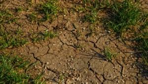
Our skilled instructors deliver personalized training on monitoring and managing soil erosion through remote sensing. The sessions include hands-on training using QGIS.
Original price was: ₹1,999.00.₹449.00Current price is: ₹449.00.
Course Player Test Product
What You Will Learn
- Introduction Soil Erosion Estimation Models
- Measures of Overland Flow, Time Interval, Velocity and Coefficient
- Sources and techniques of data collection
- Data Conversion and Band Composition
- Raster Interpolation and Calculation
- Soil Loss Estimation
- Estimation of Sediment Yield
- USLE Model
This Course Includes
- 37.5 hours on-demand video
- 2 articles
- 4 downloadable resources
- Access on mobile and TV
- Closed captions
- Certificate of completion
Requirements
- No coding or design experience necessary
- Any computer works – Windows, macOS or Linux
- You don’t need to buy any software – we will use the best free code editor in the world
Description
Basic Remote Sensing Course
Learn the fundamentals of remote sensing in soil erosion estimation with our course outline and certification option.
Remote Sensing Training Sessions

Join our hands-on training sessions using QGIS to effectively monitor and manage soil erosion.
Course Player Test Product
Our skilled instructors deliver personalized training on monitoring and managing soil erosion through remote sensing. The sessions include hands-on training using QGIS.
Original price was: ₹1,999.00.₹449.00Current price is: ₹449.00.